


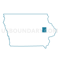
ELY Voting District, Linn County, Iowa
About
Outline

Summary
| Unique Area Identifier | 582685 |
| Name | ELY Voting District |
| County | Linn County |
| State | Iowa |
| Area (square miles) | 1.44 |
| Land Area (square miles) | 1.44 |
| Water Area (square miles) | 0.00 |
| % of Land Area | 99.72 |
| % of Water Area | 0.28 |
| Latitude of the Internal Point | 41.87973350 |
| Longtitude of the Internal Point | -91.58719840 |
Maps


Graphs
Select a template below for downloading or customizing gragh for ELY Voting District, Linn County, Iowa


Neighbors
Neighoring Voting District (by Name) Neighboring Voting District on the Map
- COLLEGE TWP PART W/O ELY Voting District, Linn County, IA
- PUTNAM TWP W/O ELY Voting District, Linn County, IA